# us-atlas
**Repository Path**: lengjianjun/us-atlas
## Basic Information
- **Project Name**: us-atlas
- **Description**: 由topojson依赖。详见https://gitee.com/lengjianjun/topojson
- **Primary Language**: Unknown
- **License**: ISC
- **Default Branch**: master
- **Homepage**: None
- **GVP Project**: No
## Statistics
- **Stars**: 0
- **Forks**: 0
- **Created**: 2025-06-05
- **Last Updated**: 2025-06-05
## Categories & Tags
**Categories**: Uncategorized
**Tags**: None
## README
# U.S. Atlas TopoJSON
This repository provides a convenient redistribution of the [Census Bureau’s](http://www.census.gov/) [cartographic boundary shapefiles](https://www.census.gov/geographies/mapping-files/time-series/geo/carto-boundary-file.html), 2017 edition as TopoJSON. For earlier editions, see [past releases](https://github.com/topojson/us-atlas/releases). Both projected and unprojected geometries are included. The projection used by these files is:
```js
d3.geoAlbersUsa().scale(1300).translate([487.5, 305])
````
This is a conic equal-area Albers projection suitable for choropleth maps and designed to fit a 975×610 viewport.
### Usage
In a browser, using [d3-geo](https://github.com/d3/d3-geo) and SVG:
https://observablehq.com/@d3/u-s-map
In a browser, using [d3-geo](https://github.com/d3/d3-geo) and Canvas:
https://observablehq.com/@d3/u-s-map-canvas
In Node, using [d3-geo](https://github.com/d3/d3-geo) and [node-canvas](https://github.com/Automattic/node-canvas):
https://bl.ocks.org/mbostock/885fffe88d72b2a25c090e0bbbef382f
## File Reference
# counties-10m.json · [Download](https://cdn.jsdelivr.net/npm/us-atlas@3/counties-10m.json "Source")
A [TopoJSON file](https://github.com/topojson/topojson-specification/blob/master/README.md#21-topology-objects) containing the geometry collections counties, states, and nation. The geometry is quantized and simplified, but not projected. This topology is derived from the Census Bureau’s [cartographic county boundaries, 2017 edition](https://www2.census.gov/geo/tiger/GENZ2017/shp/). The state boundaries are computed by [merging](https://github.com/topojson/topojson-client/blob/master/README.md#merge) counties, and the nation boundary is computed by merging states, ensuring a consistent topology.
# counties-albers-10m.json · [Download](https://cdn.jsdelivr.net/npm/us-atlas@3/counties-albers-10m.json "Source")
A [TopoJSON file](https://github.com/topojson/topojson-specification/blob/master/README.md#21-topology-objects) containing the geometry collections counties, states, and nation. The geometry is quantized, projected using [d3.geoAlbersUsa](https://github.com/d3/d3-geo/blob/master/README.md#geoAlbersUsa) to fit a 975×610 viewport, and simplified. This topology is derived from the Census Bureau’s [cartographic county boundaries, 2017 edition](https://www2.census.gov/geo/tiger/GENZ2017/shp/). The state boundaries are computed by [merging](https://github.com/topojson/topojson-client/blob/master/README.md#merge) counties, and the nation boundary is computed by merging states, ensuring a consistent topology.
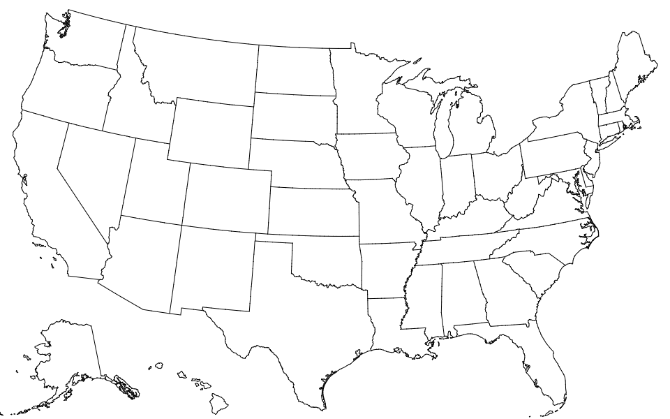
# states-10m.json · [Download](https://cdn.jsdelivr.net/npm/us-atlas@3/states-10m.json "Source")
A [TopoJSON file](https://github.com/topojson/topojson-specification/blob/master/README.md#21-topology-objects) containing the geometry collections states and nation. The geometry is quantized and simplified, but not projected. This topology is derived from the Census Bureau’s [cartographic state boundaries, 2017 edition](https://www2.census.gov/geo/tiger/GENZ2017/shp/). The nation boundary is computed by [merging](https://github.com/topojson/topojson-client/blob/master/README.md#merge) states, ensuring a consistent topology.
# states-albers-10m.json · [Download](https://cdn.jsdelivr.net/npm/us-atlas@3/states-albers-10m.json "Source")
A [TopoJSON file](https://github.com/topojson/topojson-specification/blob/master/README.md#21-topology-objects) containing the geometry collections states and nation. The geometry is quantized, projected using [d3.geoAlbersUsa](https://github.com/d3/d3-geo/blob/master/README.md#geoAlbersUsa) to fit a 975×610 viewport, and simplified. This topology is derived from the Census Bureau’s [cartographic state boundaries, 2017 edition](https://www2.census.gov/geo/tiger/GENZ2017/shp/). The nation boundary is computed by [merging](https://github.com/topojson/topojson-client/blob/master/README.md#merge) states, ensuring a consistent topology.
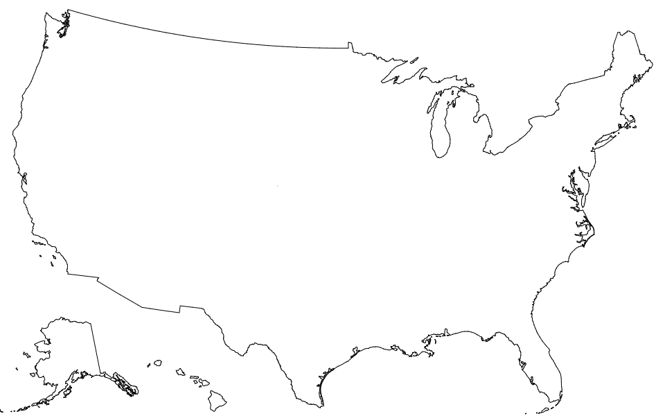
# nation-10m.json · [Download](https://cdn.jsdelivr.net/npm/us-atlas@3/nation-10m.json "Source")
A [TopoJSON file](https://github.com/topojson/topojson-specification/blob/master/README.md#21-topology-objects) containing the geometry collection nation. The geometry is quantized and simplified, but not projected. This topology is derived from the Census Bureau’s [cartographic nation boundary, 2017 edition](https://www2.census.gov/geo/tiger/GENZ2017/shp/).
# nation-albers-10m.json · [Download](https://cdn.jsdelivr.net/npm/us-atlas@3/nation-albers-10m.json "Source")
A [TopoJSON file](https://github.com/topojson/topojson-specification/blob/master/README.md#21-topology-objects) containing the geometry collection nation. The geometry is quantized, projected using [d3.geoAlbersUsa](https://github.com/d3/d3-geo/blob/master/README.md#geoAlbersUsa) to fit a 975×610 viewport, and simplified. This topology is derived from the Census Bureau’s [cartographic nation boundary, 2017 edition](https://www2.census.gov/geo/tiger/GENZ2017/shp/).
# *us*.objects.counties
 Each county has two fields:
* *county*.id - the five-digit [FIPS county code](https://en.wikipedia.org/wiki/FIPS_county_code), such as `"06069"`
* *county*.properties.name - the county name, such as `"San Benito"`
The first two digits of the county FIPS code is the state FIPS code.
# *us*.objects.states
Each county has two fields:
* *county*.id - the five-digit [FIPS county code](https://en.wikipedia.org/wiki/FIPS_county_code), such as `"06069"`
* *county*.properties.name - the county name, such as `"San Benito"`
The first two digits of the county FIPS code is the state FIPS code.
# *us*.objects.states
 Each state has two fields:
* *state*.id - the two-digit [FIPS state code](https://en.wikipedia.org/wiki/Federal_Information_Processing_Standard_state_code), such as `"06"`
* *state*.properties.name - the state name, such as `"California"`
# *us*.objects.nation
Each state has two fields:
* *state*.id - the two-digit [FIPS state code](https://en.wikipedia.org/wiki/Federal_Information_Processing_Standard_state_code), such as `"06"`
* *state*.properties.name - the state name, such as `"California"`
# *us*.objects.nation
 The nation has two fields:
* *nation*.id - the string `"US"`
* *nation*.properties.name - the string `"United States"`
The nation has two fields:
* *nation*.id - the string `"US"`
* *nation*.properties.name - the string `"United States"`